艾沃區
外觀
| 艾沃區 | |
|---|---|
| 區 | |
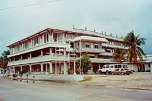
 艾沃區的中心市街 | |
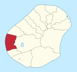
 艾沃區在瑙魯的位置 | |
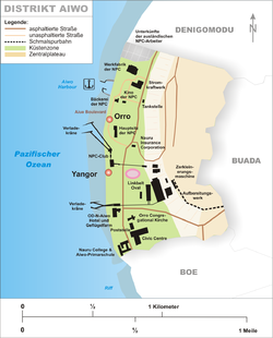
 艾沃區地圖 | |
| 坐標:0°31′48″S 166°54′42″E / 0.53°S 166.91166666667°E | |
| 國家 | |
| 選區 | 艾沃選區 |
| 面積 | |
| • 總計 | 1.1 平方公里(0.4 平方英里) |
| 海拔 | 26 公尺(85 英尺) |
| 人口(2011年) | |
| • 總計 | 1,220人 |
| 時區 | (UTC+12) |
| 國際電話區號 | +674 |
| 氣候 | 熱帶雨林氣候 |
艾沃區[1](英語:Aiwo District)是太平洋島國諾魯的一個行政區,位於該島的西部。平均海拔26公尺,最高海拔65米[2](司令嶺);二次大戰日本軍佔領此山嶺成立戰地司令部為名稱之由來)。艾沃區屬於艾沃選舉區。
建設
[編輯]
最早的村落
[編輯]- Aiwo
- Aribweabwe
- Eaterienago
- Eatoborowada
- Gabab
- Orro
- Tebata
- Tsigamei
教育
[編輯]艾沃小學曾在艾沃開辦。[3]截至2002年4月,它為來自瑙魯各地的三年級和四年級學生提供服務。[4] 南太平洋大學瑙魯校區原位於艾沃區[5],2018年遷至亞倫區[6]。
名人
[編輯]-
橢圓形體育場
-
磷酸鹽加工處理廠
-
磷酸鹽公司所屬貨運線
-
磷酸鹽礦開採遺跡
參考文獻
[編輯]- ^ 周定國 (編). Aiwo Dist. 艾沃区 [瑙]. 世界地名翻译大辞典. 北京: 中國對外翻譯出版公司. 2008-01. ISBN 978-7-500-10753-8. OCLC 885528603. OL 23943703M. NLC 003756704.(簡體中文)
- ^ "Nauru High Point" on Peakbagger (頁面存檔備份,存於互聯網檔案館) Retrieved 24 September 2011
- ^ "Attitudinal Survey Report on the Delivery of HIV and Sexual Reproductive Health Education in School Settings in Nauru HIV and Sexual Reproductive Health Education in School Settings in Nauru (頁面存檔備份,存於互聯網檔案館)."
- ^ Brandjes, Denis (preparer). "Page 1 THE COMMONWEALTH OF LEARNING School Networking in the Pacific Island States An Environmental Scan and Plan for the Establishment of Schoolnets for the Pacific Island States (頁面存檔備份,存於互聯網檔案館)." April 2002. p. 49 (PDF p. 51).
- ^ "Nauru Campus." University of the South Pacific. March 17, 2011. Retrieved on September 29, 2018. "It is currently located in the Aiwo District."
- ^ "Nauru Campus (頁面存檔備份,存於互聯網檔案館)." University of the South Pacific. Retrieved on September 29, 2018. "2018 is indeed a year of celebrations. We will soon be moving to our spectacular new, state-of-the-art campus at the Learning Village in Yaren District."
- ^ Nauru. 2019-08-09 [2021-03-02]. (原始內容存檔於9 August 2019).
| 這是一篇關於大洋洲地理位置的小作品。您可以透過編輯或修訂擴充其內容。 |


