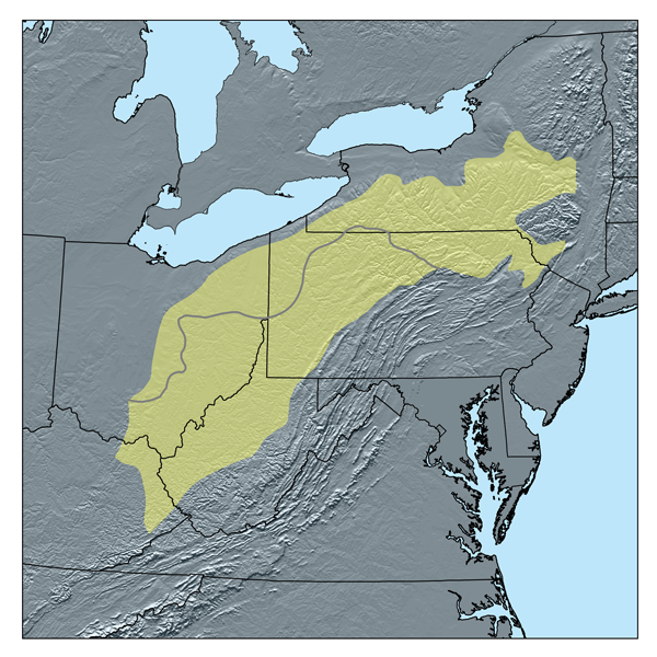
File:Alleghenyplateaumap.png
外观
Alleghenyplateaumap.png (600 × 600像素,文件大小:540 KB,MIME类型:image/png)
文件历史
点击某个日期/时间查看对应时刻的文件。
| 日期/时间 | 缩略图 | 大小 | 用户 | 备注 | |
|---|---|---|---|---|---|
| 当前 | 2007年1月12日 (五) 21:31 |  | 600 × 600(540 KB) | Kmusser | This is a map of the Allegheny Plateau as defined by ecoregions.[http://www.epa.gov/wed/pages/ecoregions/na_eco.htm#Level%20III] I, Karl Musser, created it based on USGS and EPA data |
文件用途
以下页面使用本文件:
全域文件用途
以下其他wiki使用此文件:
- bg.wikipedia.org上的用途
- cs.wikipedia.org上的用途
- el.wikipedia.org上的用途
- en.wikipedia.org上的用途
- eo.wikipedia.org上的用途
- es.wikipedia.org上的用途
- fi.wikipedia.org上的用途
- fr.wikipedia.org上的用途
- hu.wikipedia.org上的用途
- id.wikipedia.org上的用途
- ja.wikipedia.org上的用途
- pl.wikipedia.org上的用途
- ru.wikipedia.org上的用途


