
File:Map of Greece, Archipelago and part of Anadoli; Louis Stanislas d'Arcy Delarochette 1791.jpg

預覽大小:800 × 561 像素。 其他解析度:320 × 225 像素 | 640 × 449 像素 | 1,024 × 719 像素 | 1,280 × 898 像素 | 2,560 × 1,797 像素 | 9,411 × 6,605 像素。
原始檔案 (9,411 × 6,605 像素,檔案大小:15.99 MB,MIME 類型:image/jpeg)
摘要
| 描述 |
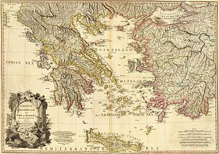
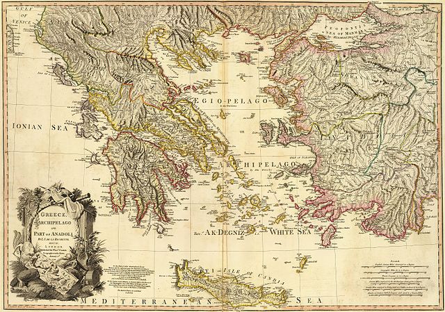
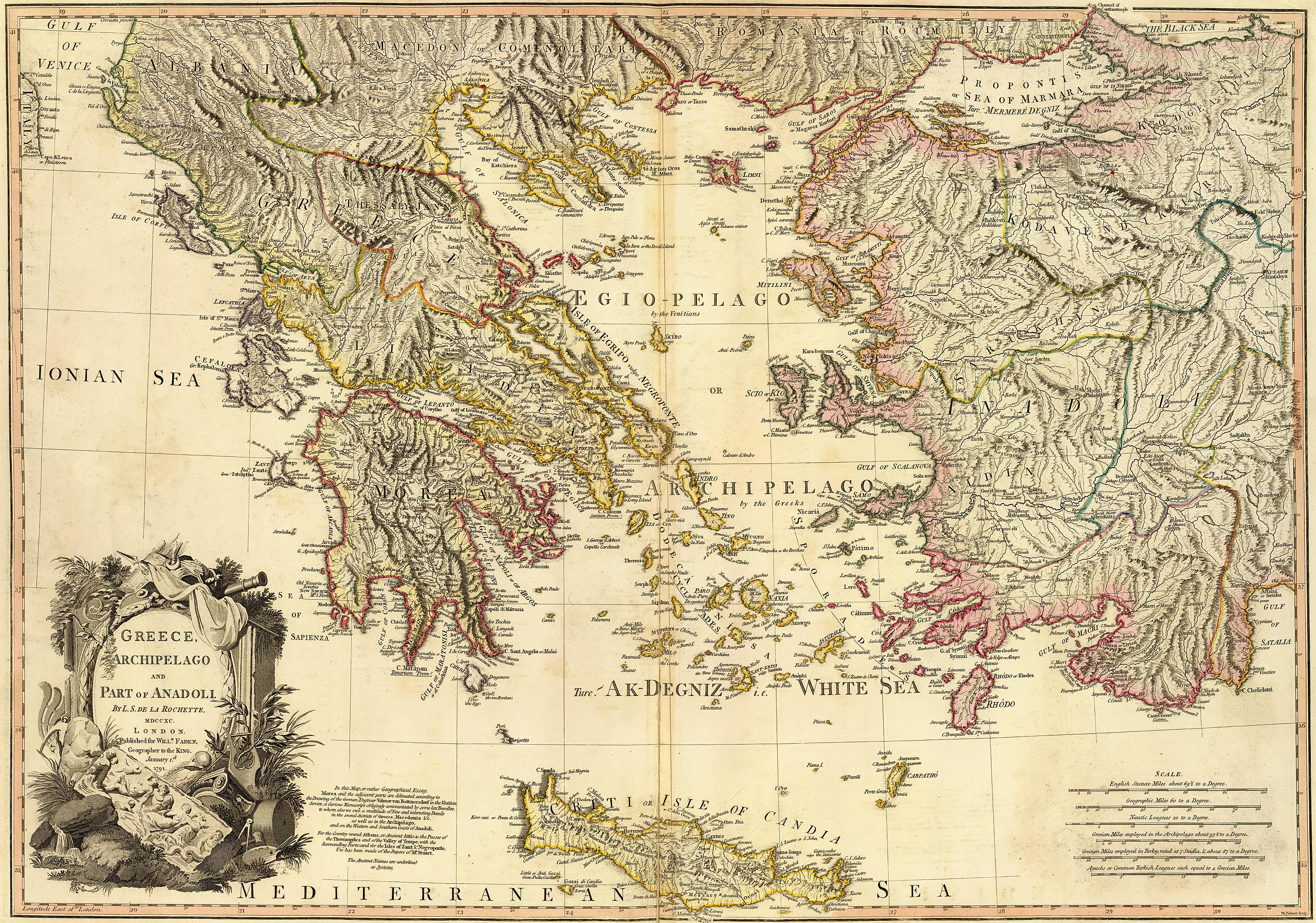
Greece, Archipelago and part of Anadoli. Published for Willm. Faden, Geographer to the King. W. Palmer sculp. . Scale: 1,350,000 |
| 日期 | |
| 來源 | http://www.davidrumsey.com/luna/servlet/detail/RUMSEY~8~1~24845~960053?trs=120&mi=23&qvq=mgid%3A2728# |
| 作者 | Louis Stanislas d'Arcy Delarochette |
| 其他版本 |
|
.jpg)
.jpg)
.jpg)
授權條款
|
本作品在其來源國以及其他著作權期限是作者逝世後100年或以下的國家與地區屬於公有領域。 | |
| 此作品無已知的著作權限制,亦不受所有相關和鄰接的權利限制。 | |
| 警告 | 部分瀏覽器在瀏覽此圖片的完整大小時可能會遇到困難:該圖片中有數量巨大的像素點,可能無法完全載入或者導致您的瀏覽器停止回應。 |
|---|
| 註解 | 該圖片含有註解:在維基媒體共享資源上查看註解 |

檔案歷史
點選日期/時間以檢視該時間的檔案版本。
| 日期/時間 | 縮圖 | 尺寸 | 使用者 | 備註 | |
|---|---|---|---|---|---|
| 目前 | 2016年6月9日 (四) 15:05 | | 9,411 × 6,605(15.99 MB) | HerrAdams | Removed border by cropping 20 % horizontally and 13 % vertically using CropTool with lossless mode. |
| 2016年5月4日 (三) 17:11 |  | 11,730 × 7,600(20.32 MB) | Mattes | == {{int:filedesc}} == {{Information |Description= Greece, Archipelago and part of Anadoli. By L.S. de la Rochette, MDCCXC. London. Published for Willm. Faden, Geographer to the King. January 1st, 1791. W. Palmer sculp. . Scale: 1,350,000 |Source=http:... |
檔案用途
下列27個頁面有用到此檔案:
全域檔案使用狀況
以下其他 wiki 使用了這個檔案:
- en.wikipedia.org 的使用狀況
- Aegean civilization
- Dorians
- Ostracism
- History of Cyprus
- Timeline of ancient Greece
- Ancient Greece
- Miletus
- Minoan civilization
- Pelasgians
- Greek War of Independence
- Ionians
- Greek Dark Ages
- Cycladic culture
- Hellenistic period
- History of Greece
- Mycenaean Greece
- Hellenistic Greece
- Byzantine Greece
- Ottoman Greece
- Dorian invasion
- Template:History of Greece
- Aeolians
- Helladic chronology
- Archaic Greece
- Greek junta
- Military history of Greece
- Greece in the Roman era
- Ionian League
- 4th of August Regime
- Names of the Greeks
- National Schism
- History of modern Macedonia (Greece)
- Chronology of ancient Greek mathematicians
- History of the Hellenic Republic
- Timeline of modern Greek history
- Second Hellenic Republic
- Economic history of Greece and the Greek world
- Talk:History of the Assyrians
- Classical Greece
- User:Athinaios/Sandbox
- Hellenic State (1941–1944)
- Frankokratia
- Timeline of ancient Greek mathematicians
- Timeline of calculus and mathematical analysis
- History of Sparta
- Greece in the Balkan Wars
- Background of the Greek War of Independence
- Achaeans (tribe)
- Category:History of Greece by period
- Venetian rule in the Ionian Islands
檢視此檔案的更多全域使用狀況。