修適士徑
 | |
|---|---|
 | |
| 類型 | 街道 |
| 道路長度 | 2.4公里(1.5英里)[1] |
| 地點 | 渥太華 |
| 道路走向 | 北-南 |
| 北端 | 麗都門(Rideau Gate) (延續為卡提耶徑) |
| 南端 | 麗都街 |
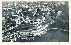
修適士徑(英語:Sussex Drive;法語:promenade Sussex;渥太華93號市道)是加拿大安大略省渥太華的一條主幹道。修適士徑與渥太華河大致平行,北始於麗都門(Rideau Gate)的卡提耶徑的延續,位於麗都廳的入口處。該道路向南延伸到麗都街,聖博德街(St. Patrick Street)以南的部分與麥健時路(Mackenzie Avenue)形成單向對的北行一半。麥健時路及修適士徑都在其南端與拜副將徑(Colonel By Drive)相連,沿麗都運河向南延伸。
20世紀初,修適士街(Sussex Street)沿線建立了許多政府機構,二戰後設立了各國大使館。1953年11月,在伊利沙伯皇太后訪問期間,修適士街更名為修適士徑。
參見[编辑]
參考文獻[编辑]
- ^ Google Inc. Sussex Drive – Length and Route (地图). Google Inc. October 19, 2020 [October 19, 2020].
延伸閱讀[编辑]
- Brault, Lucien. Ottawa, Old & New. Ottawa Historical Information Institute. January 16, 1946 [June 18, 2012].
外部連結[编辑]
| |||||||||||||||||||||||||||
