佛羅里達州第二十六國會選區
外觀
| 佛羅里達州第二十六國會選區 | |||
|---|---|---|---|
 自2023年1月3日以來的選區地圖(紅框範圍) | |||
| 議員 |
| ||
| 面積 | 5,171[1]平方英里(13,390平方公里) | ||
| 城鄉分布 |
| ||
| 人口(2022) | 796,673[3] | ||
| 住戶收入中位數 | $67,071[3] | ||
| 種族組成 | |||
| 庫克黨派投票指數 | R+8[4] | ||
佛羅里達州第二十六國會選區(英語:Florida's 26th congressional district)為美國國會之選區,2012年成立於佛羅里達州南部[5]。首批候選人角逐競爭2012年美國眾議院選舉,當選者於2013年1月3日就任為第113屆美國國會議員。
第二十六國會選區位於佛羅里達州南部,其中包含門羅縣全縣、邁阿密-戴德縣西南部[6][7]。從地理上,此選區為繼承自原佛羅里達州第二十五國會選區。也是美國在本土48州及其所在的美洲大陸中最南端的選區。
選區內較為著名之地點包含基韋斯特,以及大沼澤地國家公園、比斯坎國家公園、海龜國家公園等三座國家公園。
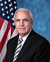
此選區之現任國會議員為共和黨籍的卡洛斯·A·吉梅內斯。
總統選舉結果
[編輯]此選區之歷屆總統選舉結果:
| 年份 | 選舉 | 結果 |
|---|---|---|
| 2012 | 2012年美國總統選舉 | 巴拉克·歐巴馬 55.4%-米特·羅姆尼 43.9% |
| 2016 | 2016年美國總統選舉 | 希拉蕊·柯林頓 56.7%-唐納·川普 40.6% |
| 2020 | 2020年美國總統選舉 | 唐納·川普 52.4% - 喬·拜登 46.9% |
歷任眾議員
[編輯]| 眾議員 | 黨籍 | 任期 | 國會屆次 | 選舉歷史 | 選區分布 |
|---|---|---|---|---|---|
 喬·加西亞 (José Antonio Garcia Jr.) |
2013年1月3日-2015年1月3日 | 第113屆美國國會 | 2012年當選 連任失利 |

| |
 卡洛斯·柯貝羅 (Carlos Curbelo) |
2015年1月3日-2019年1月3日 | 第114屆美國國會 第115屆美國國會 |
2014年當選 2016年連任 連任失利 | ||

| |||||
 黛比·穆薩爾-鮑爾 (Debbie Jessika Mucarsel-Powell) |
2019年1月3日-2021年1月3日 | 第116屆美國國會 | 2018年當選 連任失利 | ||
 卡洛斯·A·吉梅內斯 |
2021年1月3日至今 | 第117屆美國國會 | 2020年當選 | 
|
尚在世之前眾議員
[編輯]截至2019年1月,仍有2名前眾議員尚在世。
| 眾議員 | 任期 | 出生 |
|---|---|---|
| 喬·加西亞 | 2013年1月3日-2015年1月3日 | 1963年10月12日 |
| 卡洛斯·柯貝羅 | 2015年1月3日-2019年1月3日 | 1980年3月1日 |
| 黛比·穆薩爾-鮑爾 | 2019年1月3日-2021年1月3日 | 1971年1月18日 |
另見
[編輯]- 2012年成立的選舉區
- 2012年裁撤的選舉區
參考資料
[編輯]- ^ Congressional Plan--SC14-1905 (Ordered by The Florida Supreme Court, 2-December-2015) (PDF). Florida Senate Committee on Reapportionment. [January 11, 2017]. (原始內容存檔 (PDF)於2020-11-05).
- ^ Geography, US Census Bureau. Congressional Districts Relationship Files (state-based). www.census.gov. [2019-03-26]. (原始內容存檔於2013-04-02).
- ^ 3.0 3.1 Bureau, Center for New Media & Promotion (CNMP), US Census. My Congressional District. www.census.gov. [2019-03-26]. (原始內容存檔於2020-11-29).
- ^ 2022 Cook PVI: District Map and List. Cook Political Report. [2023-01-10]. (原始內容存檔於2022-12-27) (英語).
- ^ Census 2010 shows Red states gaining congressional districts. Washington Post. [2010-12-21]. (原始內容存檔於2011-10-17).
- ^ h9047_35x42L.pdf (頁面存檔備份,存於網際網路檔案館) Congressional Plan: H000C9047. Chapter No. 2012-2, Laws of Florida. www.flsenate.gov. February 16, 2012.
- ^ H000C9047_map_se.pdf (PDF). [2019-03-26]. (原始內容存檔 (PDF)於2019-03-27).
