聖誕島 (基里巴斯)
外觀
| 聖誕島 (Christmas Island) | |
|---|---|
 國際太空站拍攝的聖誕島 | |
 | |
| 地理 | |
| 位置 | 南太平洋 |
| 坐標 | 01°51′00″N 157°24′00″W / 1.85000°N 157.40000°W |
| 群島 | 萊恩群島 |
| 面積 | 388.39平方公里(149.96平方英里) |
| 最高海拔 | 13米(43英尺) |
| 最高點 | Joe's Hill |
| 管轄 | |
| Island council | Kiritimati |
| 最大settlement | Tabwakea(人口3,547) |
| 人口統計 | |
| 人口 | 7,380(2020 census) |
| 人口密度 | 16.6人/平方公里(43人/平方英里) |
| 語言 | 吉里巴斯語 |
| 族群 | 吉爾伯特人 |
| 其他資料 | |
| 時區 | |

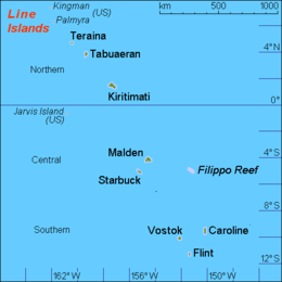
聖誕島(基里巴斯語:Kiritimati,國際音標:[kiˈrɪsmæs],音譯:基里斯馬斯,即聖誕島的意思)是太平洋的一個珊瑚礁,太平洋上最大環礁,位於萊恩群島,陸地面積為363平方公里,佔基里巴斯全國土地的70%,目前人口約有2,600人。它在1777年聖誕節前夕由詹姆斯·庫克船長發現,所以此島名為聖誕島。此島擁有全世界最大的珊瑚礁,而且是現存最古老的珊瑚礁。在1956年到1962年之間,英美兩國在此進行核試。
1970年後開始種植椰子。為夏威夷到塔拉瓦島航空線的中途停降站。
該島早期是以豐富的海鳥和磷礦資源聞名於世界。
交通
[編輯]現有由斐濟航空於每週三執飛,自夏威夷檀香山國際機場起飛,經聖誕島卡西迪國際機場前往斐濟楠迪國際機場的FJ823航班。
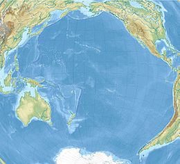
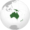
地理位置
[編輯]氣候
[編輯]外部連結
[編輯]- Kiritimati (PDF). climate.gov.ki. Official government report on the island's infrastructure, ecology, and ongoing issues. 2013-01-20 [28 April 2015]. (原始內容 (PDF)存檔於14 July 2016).
- William Ellis' plate 64. Picture library. piclib.nhm.ac.uk. London, UK: Natural History Museum. [15 October 2012]. (原始內容存檔於2013-12-02).
The only Kiritimati Sandpiper specimen ever studied by scientists.
- Photos of British nuclear tests off Christmas Island. lorry.org/cassandra. [2024-01-31]. (原始內容存檔於2023-12-10).
- Various pictures of Kiritimati. pbase.com/keithcollicoat. Christmas Island :: Kiritimati. [2024-01-31]. (原始內容存檔於2023-06-07).
- Kiribati National Tourism Office. [2024-01-31]. (原始內容存檔於2010-04-01).


