北普拉特 (內布拉斯加州)
外觀
| 北普拉特 North Platte, Nebraska | |
|---|---|
| 城市 | |
 Golden Spike Tower and visitor center at Union Pacific's Bailey Yards | |
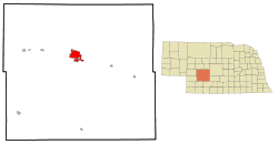
 北普拉特在內布拉斯加州的位置 | |
| 坐標:41°08′09″N 100°46′14″W / 41.135914°N 100.770501°W | |
| 國家 | 美國 |
| 州 | 內布拉斯加州 |
| 縣 | 林肯縣 |
| 政府 | |
| • 市長 | Dwight Livingston[1] |
| • Legislature | Tom Hansen |
| • 國會選區 | Adrian Smith (R) |
| 面積 | |
| • 總計 | 13.39 平方英里(34.68 平方公里) |
| • 陸地 | 13.20 平方英里(34.19 平方公里) |
| • 水域 | 0.19 平方英里(0.49 平方公里) |
| 海拔 | 2,802 英尺(854 公尺) |
| 人口(2010) | |
| • 總計 | 24,733人 |
| • 估計(2012[2]) | 24,592 |
| • 密度 | 1,873.7人/平方英里(723.4人/平方公里) |
| 時區 | 中部時區 (CST)(UTC-6) |
| • 夏時制 | CDT(UTC-5) |
| 郵區編號 | 69101, 69103 |
| 電話區號 | 308 |
| FIPS代碼 | 31-35000 |
| GNIS特徵ID | 0831719[3] |
| 網站 | City Website |
北普拉特(英語:North Platte)是美國內布拉斯加州林肯縣的縣治[4],南靠80號州際公路,東側為北普拉特河與南普拉特河合流為普拉特河的交匯點,2010年的人口為24,733人[5]。
地理
[編輯]| 內布拉斯加州北普拉特(北普拉特地域機場),1991–2020年正常值,1874年至今極端數據 | |||||||||||||
|---|---|---|---|---|---|---|---|---|---|---|---|---|---|
| 月份 | 1月 | 2月 | 3月 | 4月 | 5月 | 6月 | 7月 | 8月 | 9月 | 10月 | 11月 | 12月 | 全年 |
| 歷史最高溫 °C(°F) | 23 (74) |
26 (79) |
33 (91) |
37 (98) |
37 (99) |
42 (108) |
44 (112) |
42 (108) |
41 (105) |
36 (96) |
31 (87) |
24 (76) |
44 (112) |
| 平均最高溫 °C(°F) | 17.0 (62.6) |
19.3 (66.7) |
25.5 (77.9) |
29.3 (84.8) |
32.2 (90.0) |
36.1 (96.9) |
38.1 (100.6) |
36.6 (97.9) |
35.2 (95.3) |
30.2 (86.3) |
23.3 (73.9) |
17.6 (63.7) |
38.9 (102.0) |
| 平均高溫 °C(°F) | 4.8 (40.7) |
6.6 (43.9) |
12.9 (55.2) |
17.3 (63.2) |
22.7 (72.8) |
28.9 (84.0) |
32.1 (89.7) |
30.7 (87.2) |
26.7 (80.0) |
18.9 (66.0) |
11.4 (52.6) |
5.6 (42.0) |
18.2 (64.8) |
| 平均低溫 °C(°F) | −11.2 (11.9) |
−9.6 (14.8) |
−4.5 (23.9) |
0.7 (33.2) |
6.8 (44.2) |
13.0 (55.4) |
16.3 (61.4) |
14.9 (58.8) |
9.1 (48.3) |
1.3 (34.3) |
−5.9 (21.4) |
−10.5 (13.1) |
1.7 (35.1) |
| 平均最低溫 °C(°F) | −22.3 (−8.2) |
−20.6 (−5.1) |
−15.2 (4.6) |
−8.3 (17.1) |
−2.5 (27.5) |
5.2 (41.4) |
9.7 (49.5) |
8.3 (46.9) |
−0.2 (31.7) |
−8.3 (17.0) |
−15.4 (4.3) |
−20.6 (−5.1) |
−25.8 (−14.5) |
| 歷史最低溫 °C(°F) | −37 (−35) |
−37 (−35) |
−32 (−25) |
−19 (−3) |
−8 (18) |
−2 (29) |
4 (39) |
2 (35) |
−8 (17) |
−16 (4) |
−32 (−25) |
−37 (−34) |
−37 (−35) |
| 平均降水量 mm(吋) | 9.9 (0.39) |
14 (0.57) |
25 (1.00) |
58 (2.29) |
85 (3.35) |
90 (3.54) |
81 (3.18) |
65 (2.56) |
41 (1.61) |
42 (1.65) |
12 (0.49) |
11 (0.45) |
535 (21.08) |
| 平均降雪量 cm(吋) | 13 (5.1) |
18 (6.9) |
11 (4.2) |
9.1 (3.6) |
0.0 (0.0) |
0.0 (0.0) |
0.0 (0.0) |
0.0 (0.0) |
0.25 (0.1) |
5.6 (2.2) |
7.6 (3.0) |
11 (4.5) |
75 (29.6) |
| 平均降水天數(≥ 0.01 in) | 4.4 | 5.3 | 6.5 | 9.0 | 11.5 | 10.8 | 10.2 | 8.9 | 6.7 | 6.8 | 4.2 | 3.7 | 88.0 |
| 平均降雪天數(≥ 0.1 in) | 4.3 | 4.3 | 3.4 | 2.2 | 0.1 | 0.0 | 0.0 | 0.0 | 0.1 | 0.9 | 2.1 | 3.6 | 21.0 |
| 平均相對濕度(%) | 71 | 69 | 66 | 62 | 66 | 65 | 64 | 67 | 64 | 63 | 68 | 71 | 66 |
| 月均日照時數 | 185.0 | 180.2 | 227.4 | 257.5 | 290.8 | 322.9 | 352.9 | 319.2 | 259.5 | 236.2 | 174.0 | 170.0 | 2,975.6 |
| 可照百分比 | 62 | 60 | 61 | 64 | 65 | 71 | 77 | 75 | 69 | 69 | 59 | 59 | 67 |
| 數據來源:NOAA(1981–2010年相對濕度;1961–1990年日照)[6][7][8][9] | |||||||||||||
參考文獻
[編輯]- ^ "Livingston wins Mayoral race" by George Lauby in the North Platte Bulletin) of November 7, 2012. [2014-06-20]. (原始內容存檔於2013-12-02).
- ^ Population Estimates. United States Census Bureau. [2013-05-29]. (原始內容存檔於2013-06-17).
- ^ US Board on Geographic Names. United States Geological Survey. 2007-10-25 [2008-01-31].
- ^ Find a County. National Association of Counties. [2011-06-07].
- ^ Incorporated Places and Minor Civil Divisions: Nebraska. Population Census. 2010 United States Census. 2011-07-18 [2011-07-30]. (原始內容存檔於2014-12-18).
- ^ Summary of Monthly Normals 1991–2020. National Oceanic and Atmospheric Administration. [2022-06-15]. (原始內容 (pdf)存檔於2021-11-27).
- ^ NowData - NOAA Online Weather Data. [2022-06-15]. (原始內容存檔於2022-07-07).
- ^ WMO Climate Normals for North Platte/Lee Bird FLD, NE 1961–1990. National Oceanic and Atmospheric Administration. [2021-11-27]. (原始內容存檔於2021-11-27).
- ^ Local Climatological Data Annual Summary with Comparative Data for NORTH PLATTE, NEBRASKA (KLBF) (PDF). National Oceanic and Atmospheric Administration: 3. [2022-06-15]. (原始內容存檔 (PDF)於2022-06-15).
延伸閱讀
[編輯]- Once Upon a Town: The Miracle of the North Platte Canteen, Bob Greene, Morrow/Avon, 2002, hardcover, 256 pages, ISBN 0-06-008196-1
外部連結
[編輯]- City of North Platte(頁面存檔備份,存於互聯網檔案館)
- North Platte Area Chamber of Commerce
- North Platte Lincoln County Convention and Visitors Bureau(頁面存檔備份,存於互聯網檔案館)
- The Golden Spike Tower & Visitor Center(頁面存檔備份,存於互聯網檔案館)
- Nebraskaland Days Annual Celebration(頁面存檔備份,存於互聯網檔案館)
- North Platte Telegraph(頁面存檔備份,存於互聯網檔案館)
- North Platte Bulletin - North Platte's Favorite Newspaper(頁面存檔備份,存於互聯網檔案館)
 維基導遊上有關North Platte的旅行指南


