斯潘古尔山口
外观
| 斯潘古尔山口 Spanggur Gap | |
|---|---|
| 位置 | |
| 坐标 | 33°34′23″N 78°46′48″E / 33.573°N 78.78°E |
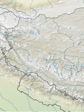
斯潘古尔山口(Spanggur Gap,印地语:स्पंगुर गैप[1])是中印边境实际控制线上的一个山口,地处班公错以南,曼冬错以西。
中印边境战争期间,印度在斯潘古尔山口设有哨所,[2][3][4]但印度后来从这里撤出,以加强对附近印度的村庄楚舒勒的防御。[5][6]
2020年5月初中印双方在班公错及乃堆拉山口,6月在加勒万河谷,并数次发生肢体冲突,造成双方人员伤亡。双方在班公错、加勒万河谷和达普桑盆地进入军事对峙,8月底班公错南岸、热钦山口附近再次造成边境局势紧张,这种情况持续至2021年2月11日,第九轮军长级会谈之后,中印两军始达成脱离接触。斯潘古尔山口两侧的中印会晤站是2020年中印边境冲突的会谈地点。


印度陆军的莫尔多(英语:Moldo)会晤站坐标: 33°33′27″N 78°43′55″E / 33.5575°N 78.732°E
中国人民解放军的斯潘古尔(英语:Spanggur)会晤站坐标: 33°33′58″N 78°47′28″E / 33.566°N 78.791°E
参考文献
[编辑]- ^ Hindi-GK. www.hindi-gk.com. seema Charan. (原始内容存档于2017-07-11).
- ^ Singh, edited by Jasjit. China's India War, 1962 : looking back to see the future. New Delhi: KW Publishers in association with Centre for Air Power Studies. 15 March 2013 [2 October 2017]. ISBN 978-93-81904-72-5.
Holding on to Spanggur Gap and Maggar Hill was now considered futile and the posts were asked to withdraw.
- ^ Thapliyal, SV. Battle of Eastern Ladakh : 1962 Sino-Indian Conflict. Journal of the United Service Institution of India. 2005, 135 (560): 282–298 [2021-07-31]. (原始内容存档于2021-07-31).
- ^ 存档副本. [2020-09-13]. (原始内容存档于2020-10-19).
- ^ Praval, Major K.C. Chapter 9. Lancer Publishers LLC. [2020-09-13]. ISBN 9781935501619. (原始内容存档于2017-03-15).
- ^ 存档副本. [2020-09-13]. (原始内容存档于2014-05-26).

