邱 (英国)
| 邱 Kew | |
|---|---|
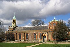
 圣安妮教区教堂 | |
 邱园的温室 | |
邱 (英国)在英国的位置 | |
| 面积 | 3.30平方千米(1.27平方英里) |
| 人口 | 11,436(2011)[2] |
| • 人口密度 | 3,465/km2(8,970/sq mi) |
| OS 格网参考 | TQ195775 |
| 大伦敦 | |
| 国家 | 英格兰 |
| 主权国家 | 英国 |
| 邮镇 | RICHMOND |
| 邮区 | TW9 |
| 电话区号 | 020 |
| 英国国会选区 | |
邱(Kew /kjuː/),或译基尤,邱区,是英国伦敦泰晤士河畔列治文区下属一区[3],是伦敦的郊区之一[4],位于查令十字西南7.1英里(11.4千米)处。邱园位于此地。法国大革命发生时有很多难民搬来,但现在已经是伦敦的富人区之一,此地没有摩天大楼,绿化良好。
“Kew”(最初写作“Cayho”)一词源自古法语的“kai”(渡口)和古英语“hoh”(突出的河岸)。[5]
参考文献[编辑]
- ^ Census Information Scheme. 2011 Census Ward Population Estimates. Greater London Authority. 2012 [30 January 2013].
- ^ Key Statistics; Quick Statistics: Population Density [1] Office for National Statistics
- ^ A City of Villages: Promoting a sustainable future for London's suburbs (PDF). SDS Technical Report 11 (Greater London Authority). August 2002 [16 January 2014]. ISBN 1-85261-393-9. (原始内容存档 (PDF)于2013-09-27).
- ^ History of Kew, in Richmond upon Thames and Surrey. A Vision of Britain through Time. GB Historical GIS / University of Portsmouth. [3 June 2014]. (原始内容存档于2017-10-23).
- ^ Room, Adrian: Dictionary of Place-Names in the British Isles, Bloomsbury, 1988, ISBN 978-0747501701
扩展阅读[编辑]
- Blomfield, David (1994). Kew Past, Chichester, Sussex: Phillimore & Co. Ltd. ISBN 0-85033-923-5
- Blomfield, David, The Story of Kew (5th, enlarged, edition), London: Leyborne Publications, 2011, ISBN 0-9520515-3-2
- Blomfield, David; May, Christopher, Kew at War 1939–1945, London: Richmond Local History Society, 2016, ISBN 978-0-9550717-4-4
- Walford, Edward, Kew, Greater London, London: Cassell & Co., 1883, OCLC 3009761
外部连接[编辑]
| 维基共享资源上的相关多媒体资源:邱 |
| 英文维基文库中的《1911年版大英百科全书》条目:Kew |
- Kew TW9 community website (页面存档备份,存于互联网档案馆)
- Kew area profile
- HistoryWorld: Kew timeline
- Richmond Local History Society (页面存档备份,存于互联网档案馆)
| ||||||||||||||||||||||||||||||||||||

