羅賴馬州市鎮列表:修订间差异
WhisperToMe(留言 | 贡献) Standardize links |
小 撤销WhisperToMe(讨论)的版本56111935 标签:撤销 |
||
| 第6行: | 第6行: | ||
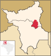
[[Image:Brazil State Roraima.svg|thumb|190px|羅賴馬州在巴西的位置]] |
[[Image:Brazil State Roraima.svg|thumb|190px|羅賴馬州在巴西的位置]] |
||
[[Image:Roraima MesoMicroMunicip zh-hant.png|thumb|190px|羅賴馬州市鎮]] |
[[Image:Roraima MesoMicroMunicip zh-hant.png|thumb|190px|羅賴馬州市鎮]] |
||
'''羅賴馬州市鎮列表'''列出位於[[巴西北部]]的[[羅賴馬州]]當前下轄的所有[[市鎮 (巴西)|市鎮]]。羅賴馬州位於[[巴西]]國內的{{link-en|亞馬遜社會地理大區|Amazônia Legal}},大部分地方都在[[亞馬遜雨林]]内,其中部與東部地帶為一片大型[[疏林草原]]。羅賴馬州也處於[[圭亚那地盾]]内,其南部為[[亞馬遜盆地]]。羅賴馬州州内有著多樣化的文化與動植物群<ref>{{cite web|url=http://www.guiadoturista.net/roraima/|title=Roraima - Apresentação|website=Guia do Turista|access-date=2019-08-15|archive-url=https://web.archive.org/web/20180630080912/https://www.guiadoturista.net/roraima/|archive-date=2018-06-30|dead-url=no}}</ref>。羅賴馬州州内經濟以服務業、農業([[大米]]、[[豆類]]、[[玉米]]和[[木薯]])、畜牧業([[牛肉]]、[[豬肉]]和[[羊肉]])和林業、採礦業([[黃金]]、[[鑽石]]、[[錫石]]等)為主。羅賴馬州是巴西[[国内生产总值]]最低的州份,而其[[人口自然增长率]]近年來出現顯著上升<ref>{{cite web|url=http://www.brasilescola.com/brasil/economia-roraima.htm|title=Economia de Roraima|website=Brasil Escola|access-date=2019-08-15|archive-url=https://web.archive.org/web/20140614180714/http://www.brasilescola.com/brasil/economia-roraima.htm|archive-date=2014-06-14|dead-url=no}}</ref><ref>{{cite web|url=http://www.ibge.gov.br/home/presidencia/noticias/noticia_visualiza.php?id_noticia=1497&id_pagina=1|title=IBGE divulga as Contas Regionais 2007|website= |
'''羅賴馬州市鎮列表'''列出位於[[巴西北部]]的[[羅賴馬州]]當前下轄的所有[[市鎮 (巴西)|市鎮]]。羅賴馬州位於[[巴西]]國內的{{link-en|亞馬遜社會地理大區|Amazônia Legal}},大部分地方都在[[亞馬遜雨林]]内,其中部與東部地帶為一片大型[[疏林草原]]。羅賴馬州也處於[[圭亚那地盾]]内,其南部為[[亞馬遜盆地]]。羅賴馬州州内有著多樣化的文化與動植物群<ref>{{cite web|url=http://www.guiadoturista.net/roraima/|title=Roraima - Apresentação|website=Guia do Turista|access-date=2019-08-15|archive-url=https://web.archive.org/web/20180630080912/https://www.guiadoturista.net/roraima/|archive-date=2018-06-30|dead-url=no}}</ref>。羅賴馬州州内經濟以服務業、農業([[大米]]、[[豆類]]、[[玉米]]和[[木薯]])、畜牧業([[牛肉]]、[[豬肉]]和[[羊肉]])和林業、採礦業([[黃金]]、[[鑽石]]、[[錫石]]等)為主。羅賴馬州是巴西[[国内生产总值]]最低的州份,而其[[人口自然增长率]]近年來出現顯著上升<ref>{{cite web|url=http://www.brasilescola.com/brasil/economia-roraima.htm|title=Economia de Roraima|website=Brasil Escola|access-date=2019-08-15|archive-url=https://web.archive.org/web/20140614180714/http://www.brasilescola.com/brasil/economia-roraima.htm|archive-date=2014-06-14|dead-url=no}}</ref><ref>{{cite web|url=http://www.ibge.gov.br/home/presidencia/noticias/noticia_visualiza.php?id_noticia=1497&id_pagina=1|title=IBGE divulga as Contas Regionais 2007|website=Instituto Brasileiro de Geografia e Estatística|date=2009-11-18|access-date=2019-08-15|archive-url=https://web.archive.org/web/20101221000901/http://www.ibge.gov.br/home/presidencia/noticias/noticia_visualiza.php?id_noticia=1497&id_pagina=1|archive-date=2010-12-21|dead-url=no}}</ref>。 |
||
自1982年7月1日《第7009號法律》通過以來,羅賴馬州共有15個市鎮<ref>{{cite web|url=http://www.jusbrasil.com.br/legislacao/128270/lei-7009-82|title=Lei no 7.009, de 1º de julho de 1982|website=JusBrasil}}</ref>。羅賴馬州是巴西市鎮數最少的州,而市鎮數第二、第三與第四少的州則分別是[[阿馬帕州]](16市鎮)、[[阿克里州]](22市鎮)與[[朗多尼亚州]](52市鎮)<ref>{{cite web|url=http://www.ibge.gov.br/ibgeteen/noticias/municipios.html|title=Municípios de até 20 mil habitantes são maioria no Brasil|website= |
自1982年7月1日《第7009號法律》通過以來,羅賴馬州共有15個市鎮<ref>{{cite web|url=http://www.jusbrasil.com.br/legislacao/128270/lei-7009-82|title=Lei no 7.009, de 1º de julho de 1982|website=JusBrasil}}</ref>。羅賴馬州是巴西市鎮數最少的州,而市鎮數第二、第三與第四少的州則分別是[[阿馬帕州]](16市鎮)、[[阿克里州]](22市鎮)與[[朗多尼亚州]](52市鎮)<ref>{{cite web|url=http://www.ibge.gov.br/ibgeteen/noticias/municipios.html|title=Municípios de até 20 mil habitantes são maioria no Brasil|website=Instituto Brasileiro de Geografia e Estatística (IBGE)|access-date=2019-08-10|archive-url=https://web.archive.org/web/20130111064650/http://www.ibge.gov.br/ibgeteen/noticias/municipios.html|archive-date=2013-01-11|dead-url=yes}}</ref>。羅賴馬州也可細分為{{link-pt|羅賴馬州中級地理區及直接地理區列表|Lista de mesorregiões e microrregiões de Roraima|兩個中級地理區與四個直接地理區}},其中兩個中級地理區為北羅賴馬({{lang|pt|Norte de Roraima}})與南羅賴馬({{lang|pt|Sul de Roraima}}),而四個直接地理區則為美景鎮({{lang|pt|Boa Vista}})、東北羅賴馬({{lang|pt|Nordeste de Roraima}})、東南羅賴馬({{lang|pt|Sudeste de Roraima}})與卡拉卡拉伊({{lang|pt|Caracaraí}})<ref name="code"/>。 |
||
{{link-en|巴西地理統計局|Brazilian Institute of Geography and Statistics}} |
{{link-en|巴西地理統計局|Brazilian Institute of Geography and Statistics}}於2018年統計,羅賴馬州人口共有{{nts|576568}}人,佔巴西人口的不到0.277%,是[[巴西行政区划|巴西各州及聯邦區]]中[[巴西各州人口列表|人口最少]]的一個<ref name="P"/>。羅賴馬州面積{{convert|224273.831|km2|sqmi}},佔巴西國土的2.635%,在巴西各州及聯邦區[[巴西各州面積列表|排名第14位]]<ref name="A"/>。羅賴馬州面積最大的市鎮是[[卡拉卡拉伊]],位於南羅賴馬中級地理區卡拉卡拉伊直接地理區<ref name="code"/>,面積{{convert|47380.375|km2|sqmi}}<ref name="A"/>;至於面積最小的市鎮則是[[聖路易斯 (羅賴馬州)|聖路易斯]],位於南羅賴馬中級地理區東南羅賴馬直接地理區<ref name="code"/>,面積{{convert|1526.898|km2|sqmi}}<ref name="A"/>。[[美景鎮 (羅賴馬州)|美景鎮]]則是羅賴馬州的首府<ref>{{cite web|url=https://cidades.ibge.gov.br/brasil/rr/panorama|title=População|website=Instituto Brasileiro de Geografia e Estatística|access-date=2019-08-15|archive-url=https://web.archive.org/web/20190331181625/https://cidades.ibge.gov.br/brasil/rr/panorama|archive-date=2019-03-31|dead-url=no}}</ref>,位於北羅賴馬中級地理區美景鎮直接地理區<ref name="code"/>,面積{{convert|5687.037|km2|sqmi}}<ref name="A"/>。羅賴馬州東鄰[[圭亚那]],北接[[委內瑞拉]],南近巴西[[亚马孙州 (巴西)|亚马孙州]],東南為巴西[[帕拉州]]<ref>{{cite web|url=http://www.portalroraima.rr.gov.br/index.php?option=com_content&task=view&id=85&itemid=1|title=Dados gerais sobre o Estado de Roraima|website=Portal do Governo de Roraima|access-date=2019-08-15|archive-url=https://web.archive.org/web/20110706164153/http://www.portalroraima.rr.gov.br/index.php?option=com_content&task=view&id=85&itemid=1|archive-date=2011-07-06|dead-url=yes}}</ref>。 |
||
== 市鎮列表 == |
== 市鎮列表 == |
||
本列表依代碼排序,並給出市鎮的名稱、代碼<ref name="code">{{cite web|url=ftp://geoftp.ibge.gov.br/organizacao_do_territorio/estrutura_territorial/divisao_territorial/2016/DTB_2016_v2.zip|title=Divisão Territorial Brasileira 2016|website= |
本列表依代碼排序,並給出市鎮的名稱、代碼<ref name="code">{{cite web|url=ftp://geoftp.ibge.gov.br/organizacao_do_territorio/estrutura_territorial/divisao_territorial/2016/DTB_2016_v2.zip|title=Divisão Territorial Brasileira 2016|website=Instituto Brasileiro de Geografia e Estatística|year=2016|accessdate=2019-08-15}}</ref>、所屬地理區<ref name="code"/>、人口<ref name="P">{{cite web|url=ftp://ftp.ibge.gov.br/Estimativas_de_Populacao/Estimativas_2018/estimativa_dou_2018_20181019.pdf|title=Estimativas da população residente no Brasil e unidades da federação com data de referência em 1º de julho de 2018|accessdate=2019-08-10|publisher=Brazilian Institute of Geography and Statistics|language=pt}}</ref>、面積<ref name="A">{{cite web|url=http://geoftp.ibge.gov.br/organizacao_do_territorio/estrutura_territorial/areas_territoriais/2018/AR_BR_RG_UF_MES_MIC_MUN_2018.xls|title=areas territoriais 2018|accessdate=2019-08-10|publisher=Instituto Brasileiro de Geografia e Estatística|language=pt|archive-url=https://web.archive.org/web/20190812023937/http://geoftp.ibge.gov.br/organizacao_do_territorio/estrutura_territorial/areas_territoriais/2018/AR_BR_RG_UF_MES_MIC_MUN_2018.xls|archive-date=2019-08-12|dead-url=no}}</ref>、人口密度(取至小數點後三位)等資料。{{legend|#ffff9a|表首府,即[[美景鎮 (羅賴馬州)|美景鎮]]}} |
||
{{legend|#ffdfd9|表各數據最大值}} |
{{legend|#ffdfd9|表各數據最大值}} |
||
{{legend|#d9efff|表各數據最小值}} |
{{legend|#d9efff|表各數據最小值}} |
||
2019年9月28日 (六) 08:26的版本


羅賴馬州市鎮列表列出位於巴西北部的羅賴馬州當前下轄的所有市鎮。羅賴馬州位於巴西國內的亞馬遜社會地理大區,大部分地方都在亞馬遜雨林内,其中部與東部地帶為一片大型疏林草原。羅賴馬州也處於圭亚那地盾内,其南部為亞馬遜盆地。羅賴馬州州内有著多樣化的文化與動植物群[1]。羅賴馬州州内經濟以服務業、農業(大米、豆類、玉米和木薯)、畜牧業(牛肉、豬肉和羊肉)和林業、採礦業(黃金、鑽石、錫石等)為主。羅賴馬州是巴西国内生产总值最低的州份,而其人口自然增长率近年來出現顯著上升[2][3]。
自1982年7月1日《第7009號法律》通過以來,羅賴馬州共有15個市鎮[4]。羅賴馬州是巴西市鎮數最少的州,而市鎮數第二、第三與第四少的州則分別是阿馬帕州(16市鎮)、阿克里州(22市鎮)與朗多尼亚州(52市鎮)[5]。羅賴馬州也可細分為兩個中級地理區與四個直接地理區,其中兩個中級地理區為北羅賴馬(Norte de Roraima)與南羅賴馬(Sul de Roraima),而四個直接地理區則為美景鎮(Boa Vista)、東北羅賴馬(Nordeste de Roraima)、東南羅賴馬(Sudeste de Roraima)與卡拉卡拉伊(Caracaraí)[6]。
巴西地理統計局於2018年統計,羅賴馬州人口共有576,568人,佔巴西人口的不到0.277%,是巴西各州及聯邦區中人口最少的一個[7]。羅賴馬州面積224,273.831平方公里(86,592.610平方英里),佔巴西國土的2.635%,在巴西各州及聯邦區排名第14位[8]。羅賴馬州面積最大的市鎮是卡拉卡拉伊,位於南羅賴馬中級地理區卡拉卡拉伊直接地理區[6],面積47,380.375平方公里(18,293.665平方英里)[8];至於面積最小的市鎮則是聖路易斯,位於南羅賴馬中級地理區東南羅賴馬直接地理區[6],面積1,526.898平方公里(589.539平方英里)[8]。美景鎮則是羅賴馬州的首府[9],位於北羅賴馬中級地理區美景鎮直接地理區[6],面積5,687.037平方公里(2,195.777平方英里)[8]。羅賴馬州東鄰圭亚那,北接委內瑞拉,南近巴西亚马孙州,東南為巴西帕拉州[10]。
市鎮列表
本列表依代碼排序,並給出市鎮的名稱、代碼[6]、所屬地理區[6]、人口[7]、面積[8]、人口密度(取至小數點後三位)等資料。
| 市鎮 | 葡萄牙文名稱 | 代碼 | 中級地理區 | 直接地理區 | 人口 | 面積 (km²) |
人口密度 (人/km²) |
地圖 |
|---|---|---|---|---|---|---|---|---|
| 阿馬雅里 | Amajari | 1400027 | 北羅賴馬 | 美景鎮 | 12,394 | 28,472.310 | 0.435 | 
|
| 上阿萊格雷 | Alto Alegre | 1400050 | 北羅賴馬 | 美景鎮 | 15,638 | 25,753.487 | 0.607 | 
|
| 美景鎮 | Boa Vista | 1400100 | 北羅賴馬 | 美景鎮 | 375,374 | 5,687.037 | 66.005 | 
|
| 邦芬 | Bonfim | 1400159 | 北羅賴馬 | 東北羅賴馬 | 12,257 | 8,095.421 | 1.514 | 
|
| 坎塔 | Cantá | 1400175 | 北羅賴馬 | 東北羅賴馬 | 17,868 | 7,664.831 | 2.331 | 
|
| 卡拉卡拉伊 | Caracaraí | 1400209 | 南羅賴馬 | 卡拉卡拉伊 | 21,564 | 47,380.375 | 0.455 | 
|
| 卡羅埃貝 | Caroebe | 1400233 | 南羅賴馬 | 東南羅賴馬 | 9,950 | 12,065.896 | 0.825 | 
|
| 伊拉塞馬 | Iracema | 1400282 | 南羅賴馬 | 卡拉卡拉伊 | 11,600 | 14,351.133 | 0.808 | 
|
| 穆卡雅伊 | Mucajaí | 1400308 | 南羅賴馬 | 卡拉卡拉伊 | 17,528 | 12,351.341 | 1.419 | 
|
| 諾曼迪亞 | Normandia | 1400407 | 北羅賴馬 | 東北羅賴馬 | 11,045 | 6,966.811 | 1.585 | 
|
| 帕卡賴馬 | Pacaraima | 1400456 | 北羅賴馬 | 美景鎮 | 15,580 | 8,028.483 | 1.941 | 
|
| 羅賴諾城 | Rorainópolis | 1400472 | 南羅賴馬 | 東南羅賴馬 | 29,533 | 33,579.739 | 0.879 | 
|
| 巴利薩的聖若昂 | São João da Baliza | 1400506 | 南羅賴馬 | 東南羅賴馬 | 8,052 | 4,284.505 | 1.879 | 
|
| 聖路易斯 | São Luís | 1400605 | 南羅賴馬 | 東南羅賴馬 | 7,860 | 1,526.898 | 5.148 | 
|
| 維拉穆唐 | Uiramutã | 1400704 | 北羅賴馬 | 東北羅賴馬 | 10,325 | 8,065.564 | 1.280 | 
|
圖集
參見
參考資料
- ^ Roraima - Apresentação. Guia do Turista. [2019-08-15]. (原始内容存档于2018-06-30).
- ^ Economia de Roraima. Brasil Escola. [2019-08-15]. (原始内容存档于2014-06-14).
- ^ IBGE divulga as Contas Regionais 2007. Instituto Brasileiro de Geografia e Estatística. 2009-11-18 [2019-08-15]. (原始内容存档于2010-12-21).
- ^ Lei no 7.009, de 1º de julho de 1982. JusBrasil.
- ^ Municípios de até 20 mil habitantes são maioria no Brasil. Instituto Brasileiro de Geografia e Estatística (IBGE). [2019-08-10]. (原始内容存档于2013-01-11).
- ^ 6.0 6.1 6.2 6.3 6.4 6.5 Divisão Territorial Brasileira 2016. Instituto Brasileiro de Geografia e Estatística. 2016 [2019-08-15].
- ^ 7.0 7.1 Estimativas da população residente no Brasil e unidades da federação com data de referência em 1º de julho de 2018 (PDF). Brazilian Institute of Geography and Statistics. [2019-08-10] (葡萄牙语).
- ^ 8.0 8.1 8.2 8.3 8.4 areas territoriais 2018. Instituto Brasileiro de Geografia e Estatística. [2019-08-10]. (原始内容存档于2019-08-12) (葡萄牙语).
- ^ População. Instituto Brasileiro de Geografia e Estatística. [2019-08-15]. (原始内容存档于2019-03-31).
- ^ Dados gerais sobre o Estado de Roraima. Portal do Governo de Roraima. [2019-08-15]. (原始内容存档于2011-07-06).
外部連結


