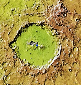
让桑陨击坑
外观
 让桑陨击坑的位置 | |
| 行星 | 火星 |
|---|---|
| 區域 | 阿拉伯区 |
| 坐标[錨點失效] | 2°42′N 37°36′E / 2.7°N 37.6°E |
| 火星方格列表 | 阿拉伯區 |
| 直径 | 154公里 |
| 命名 | 皮埃尔·让森 |


让桑陨击坑(Janssen)是火星阿拉伯区的一座撞击坑,其中心坐标位于北纬2.7度、西经322.4度处,直径154公里,该特征名称取自法国天文学家皮埃尔·朱尔·塞萨尔·让桑(1824年-1907年),1973年被国际天文联合会批准接受[1]。
下面部分陨击坑特写照片显示了坑底沉积物中的分层以及暗坡条纹,条纹颜色越深越年轻,让桑陨击坑坑底的岩层可能形成于湖底[2][3][4]。
另请查看
[编辑]参考文献
[编辑]- ^ Gazetteer of Planetary Nomenclature | Janssen. usgs.gov. International Astronomical Union. [5 March 2015]. (原始内容存档于2022-04-30).
- ^ Cabrol, N. and E. Grin. 2001. The Evolution of Lacustrine Environments on Mars: Is Mars Only Hydrologically Dormant? Icarus: 149, 291-328.
- ^ Fassett, C. and J. Head. 2008. Open-basin lakes on Mars: Distribution and implications for Noachian surface and subsurface hydrology. Icarus: 198, 37-56.
- ^ Fassett, C. and J. Head. 2008. Open-basin lakes on Mars: Implications of valley network lakes for the nature of Noachian hydrology.
| 这是一篇关于火星或其卫星的小作品。您可以通过编辑或修订扩充其内容。 |
| 这是一篇與天文學相關的小作品。您可以通过编辑或修订扩充其内容。 |
