虹灣
| 虹灣 | |
|---|---|
 | |
| 緯度 | 44.1°N |
| 經度 | 31.5°W |
| 直徑 | 236公里 |
| 命名來源 | 彩虹海灣 |


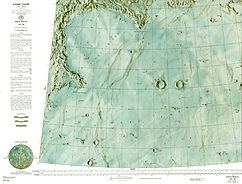
虹灣(拉丁語:Sinus Iridum)是月球上雨海西北側的一處月海區,位於一座直徑約260公里的撞擊坑中。它是被最早看見、最美麗的月海也是天文愛好者最愛的觀察對象[1][2][3]。
命名
[編輯]"虹灣"的現代名稱[4]最早是在1651年由喬瓦尼·里喬利提出,1935年被國際天文學聯合會批准採納[5]。虹灣的字面意思是「彩虹之灣」。
在此之前,該月灣的其它名稱有:1641年米迦勒·弗洛倫特·范·朗倫稱它為"幾何灣"(Sinus Geometricus)[6][7];而在1647年約翰·赫維留將它命名為"阿波羅灣"(Sinus Appollinis)[8][9][10],該名字來源於相鄰月岬(可能是拉普拉斯岬)[9],赫維留按用地球地名命名月球對象的習慣稱它為"阿波羅岬"(Promontorium Apollinis),摩洛哥人對"三叉岬"(Cape Three Forks)的舊稱[8]。
描述
[編輯]虹灣占滿整個位於雨海撞擊盆地邊緣的一座撞擊坑,該撞擊坑的直徑約260公里[11][12],月灣寬度不到10公里。東南與雨海相連,其它幾面被侏羅山脈-前述撞擊坑的殘剩坑壁所包圍。山脈伸入月海的二端形成了拉普拉斯岬(東北)和赫拉克利德岬(西南)。1679年喬瓦尼·多梅尼科·卡西尼指出[13],赫拉克利德岬的末端有點像正在眺望著拉普拉斯岬的人頭。自此以後,該地點被稱為"女人頭"或"月亮姑娘"[14][2][15],這一景象在黎明時分最相像[1]。
環虹灣的陸地山丘主要由雨海撞擊盆地及其濺射物組成,許多只有幾公里大小的隕石坑,可能就是前述撞擊坑的次級坑[11]。
虹灣表面低於月面基準高度2.5-3.0公里,其高度隨與雨海距離的加大而降低,在接近西北段的比安基尼隕石坑時達到最低點,而侏羅山脈的最高峰則較該區域高出4公里,比相鄰的夏普隕石坑坑壁還略高[16]。月灣平坦表面上的地貌特徵:只有小撞擊坑和月溝,山脊不高,邊緣是未被熔岩覆蓋的小山丘。
覆蓋虹灣的熔岩層厚度據估計有0.5公里(根據於隕石坑深度所對應直徑的評估理論)[17]。虹灣不同部分所覆蓋的熔岩成分不同:接近雨海一側部分鈦和鐵含量明顯增高,是典型的相對年輕熔岩流的成分[17][18]。
月海沿岸區域顯示重力有異常的微弱下降;而靠月海一側呈現正向增長-月海質量瘤[19][20]。
表面地貌
[編輯]
虹灣中最大的撞擊坑是位於雨海邊緣直徑8公里的"拉普拉斯 A"、4公里的衛星坑"赫拉克利特 E"及相同大小的"比安基尼 G"。這是截止2015年月灣中已命名的隕石坑[21]。 在月灣東面的月海中是一對直徑20公里的赫利孔隕石坑和勒維耶隕石坑,注意它們的濺射物,前一座的被掩蓋在月海熔岩下,而後一座的則位於熔岩表面,因為它是後來才形成的撞擊坑[12]。在侏羅山脈中坐落著三座直徑約40公里的撞擊坑:夏普隕石坑、比安基尼隕石坑和莫佩爾蒂隕石坑。比安基尼隕坑靠近月灣一側的坑壁似乎已發生崩塌[12]。
虹灣與雨海相鄰區域橫貫著數道從東北向西南伸展的無名山脊,其中最大的一條位於月灣與月海的分界線上,為雨海撞擊盆地內環山脊的一部分;它們中的一條長約200公里,高度100米。在侏羅山脈中有一條蜿蜒70公里、寬0.5公里,深約10米的狹窄月溝[17]。此外,從月灣西北到東南伸展著一條撞擊坑濺射的明亮射紋線以及眾多錯落密布的次級坑[12]。
地質史
[編輯]虹灣所位於的撞擊坑,坐落在古雨海撞擊盆地邊緣,後來,曾多次被玄武岩熔岩覆蓋[17][11]。月灣中各部分所覆蓋的熔岩地質齡及成分略有不同,不同的研究得出了這些地區不同的數值和年齡範圍[17][22][18]。 依據存續期內所累積的撞擊坑密度對該撞擊坑及虹灣熔岩層的估測,撞擊坑年齡範圍為37-38億年[11];較雨海盆地年輕,但不超過2億年[23]。但對月灣及周邊月海區的熔岩層年齡估計則不盡相同。根據其中一項研究,虹灣的地質齡為30±1億年-34±1億年不等,且越往西南區年齡則越小[22];而另一項研究得到的結果是22±5億年-33±2億年且呈朝東南(雨海)遞減的趨勢[18]。在第三種研究中,上述地點的年齡範圍為25±3億年-33±1億年,最年輕的熔岩流只位於雨海中[17]。 因此,覆蓋在虹灣表面的是屬於晚雨海世和愛拉托遜紀年代的熔岩。
覆蓋在月灣上的熔岩層固化後,仍被流動的熔漿切割出蜿蜒的凹槽。在自身重力的作用下覆蓋層產生輕微變形而形成山脊[17]。
飛船著陸
[編輯]- 1970年11月17日蘇聯月球17號在虹灣赫拉克利德岬西南(38°14′15″N 35°00′06″W / 38.2376°N 35.0016°W)實現軟著陸,並成功地運行了世界上首部探測車-月球車1號[24]。
- 2013年12月14日中國嫦娥三號探測器攜帶玉兔號月球車[25]降落在虹灣東面(44°07′17″N 19°30′42″W / 44.1214°N 19.5116°W)處。原預定著陸點為虹灣[26],該地點是中國探月研究的主要目標區之一[17]。
專題論文
[編輯]- 喬樂;肖龍; 趙健楠; 黃倩; 春山淳一. 《月球地质特征及虹湾演变史》. 中國地質大學(武漢)行星科學研究所. 2014, 101: 37–52. Bibcode:2014P&SS..101...37Q. doi:10.1016/j.pss.2014.06.007.
參考文獻
[編輯]- ^ 1.0 1.1 Wlasuk P. T. Observing the Moon 1. Springer Science & Business Media. 2000: 78–79. ISBN 978-1-852-33193-1.
- ^ 2.0 2.1 Elger T. G. The Moon. A Full Description and Map of its Principal Physical Features. London: Georg Philip & Son. 1895: 18, 80–81. (In this book, at that time the terminology of the east on the Moon called the West and vice versa)
- ^ Steven Dutch. Sinus Iridium, Moon. University of Wisconsin-Green Bay. 2007-12-17 [2015-06-09]. (原始內容存檔於2013-03-05).
- ^ Map of the Moon, made by Giovanni Francesco Grimaldi and Richcholi(1651)
- ^ Sinus Iridum. Gazetteer of Planetary Nomenclature. International Astronomical Union (IAU) Working Group for Planetary System Nomenclature (WGPSN). 2010-10-18 [2014-11-08]. (原始內容存檔於2015-06-08).
- ^ Map of the Moon, composed of Michael Van Langree (1645)
- ^ Whitaker E. A. Mapping and Naming the Moon: A History of Lunar Cartography and Nomenclature. Cambridge University Press. 2003: 200. Bibcode:2003mnm..book.....W. ISBN 9780521544146.
- ^ 8.0 8.1 Hevelius J. Selenographia sive Lunae descriptio. Gedani: Hünefeld. 1647: 226–227, 229 [2016-04-26]. doi:10.3931/e-rara-238. (原始內容存檔於2018-06-30). (Explanation of Apollinis Promontorium — on с. 229 (頁面存檔備份,存於網際網路檔案館)) 引用錯誤:帶有name屬性「Hevelius_1647」的
<ref>標籤用不同內容定義了多次 - ^ 9.0 9.1 Whitaker E. A. Mapping and Naming the Moon: A History of Lunar Cartography and Nomenclature. Cambridge University Press. 2003: 202. Bibcode:2003mnm..book.....W. ISBN 9780521544146. (In this book Apollinis word written with one "s", while Hevelius — with two).
- ^ Ferguson J., Brewster D. Ferguson's Astronomy Explained Upon Sir Isaac Newton's Principles. Edinburgh. 1811: 248.
- ^ 11.0 11.1 11.2 11.3 Wagner, R.; Head, J. W.; Wolf, U.; Neukum, G. Stratigraphic sequence and ages of volcanic units in the Gruithuisen region of the Moon. Journal of Geophysical Research (Planets). 2002, 107 (E11) [2016-04-26]. Bibcode:2002JGRE..107.5104W. doi:10.1029/2002JE001844. (原始內容存檔於2016-05-13).
- ^ 12.0 12.1 12.2 12.3 Chuck Wood. Out the Porthole. lpod.org. 2006-08-20 [2015-06-10]. (原始內容存檔於2013-04-15).
- ^ Giovanni Domenico Cassini. Map of the moon, 1679. The British Library. [2015-06-10]. (原始內容存檔於2015-06-11).
- ^ Whitaker E. A. Mapping and Naming the Moon: A History of Lunar Cartography and Nomenclature. Cambridge University Press. 2003: 79. Bibcode:2003mnm..book.....W. ISBN 9780521544146.
- ^ Roman Buckeye. Sinus Iridum. RealSky.ru. 2010-11 [2015-06-10]. (原始內容存檔於2015-06-10).
- ^ According to the laser altimeter on the satellite Lunar Reconnaissance Orbiter, obtained through the program JMARS (頁面存檔備份,存於網際網路檔案館)
- ^ 17.0 17.1 17.2 17.3 17.4 17.5 17.6 17.7 Qiao, Le; Xiao, Long; Zhao, Jiannan; Huang, Qian; Haruyama, Junichi. Geological features and evolution history of Sinus Iridum, the Moon. Planetary and Space Science. 2014, 101: 37–52. Bibcode:2014P&SS..101...37Q. doi:10.1016/j.pss.2014.06.007.
- ^ 18.0 18.1 18.2 Bugiolacchi, R.; Guest, J. E. Compositional and temporal investigation of exposed lunar basalts in the Mare Imbrium region. Icarus. 2008, 197 (1): 1–18. Bibcode:2008Icar..197....1B. doi:10.1016/j.icarus.2008.04.001.
- ^ Map of the Moon's gravitational field adjusted for height (transferred to the level of conventional sphere).
- ^ Chen, Shengbo; Meng, Zhiguo; Cui, Tengfei; Lian, Yi; Wang, Jingran; Zhang, Xuqing. Geologic investigation and mapping of the Sinus Iridum quadrangle from Clementine, SELENE, and Chang’e-1 data. Science China Physics, Mechanics and Astronomy. 2010, 53 (12): 2179–2187 [2016-04-26]. Bibcode:2010ScChG..53.2179C. doi:10.1007/s11433-010-4160-5. (原始內容存檔於2016-04-27).
- ^ According to Directory МАС (頁面存檔備份,存於網際網路檔案館) (Map of the region (頁面存檔備份,存於網際網路檔案館))
- ^ 22.0 22.1 Hiesinger H., Head J. W., Wolf U., Jaumann R., Neukum G. Ages and stratigraphy of lunar mare basalts: A synthesis (PDF). W. A. Ambrose, D. A. Williams (編). Recent Advances and Current Research Issues in Lunar Stratigraphy. Geological Society of America Special Paper 477. Geological Society of America. 2011: 18–21 [2016-04-26]. ISBN 978-0-8137-2477-5. doi:10.1130/2011.2477(01). (原始內容 (PDF)存檔於2013-01-29).
- ^ Merle, R. E.; Nemchin, A. A.; Grange, M. L.; Whitehouse, M. J.; Pidgeon, R. T. High resolution U-Pb ages of Ca-phosphates in Apollo 14 breccias: Implications for the age of the Imbrium impact. Meteoritics & Planetary Science. 2014, 49 (12): 2241–2251. Bibcode:2014M&PS...49.2241M. doi:10.1111/maps.12395.
- ^ Samuel Lawrence. LROC Coordinates of Robotic Spacecraft - 2013 Update. lroc.sese.asu.edu. 2013-09-24 [2015-06-09]. (原始內容存檔於2015-05-09).
- ^ NASA Images of Chang'e 3 Landing Site. NASA. 2013-12-30 [2015-06-09]. (原始內容存檔於2014-01-01).
- ^ David Cyranoski. China lands rover on Moon. www.nature.com. 2013-12-15 [2015-06-11]. doi:10.1038/nature.2013.14377. (原始內容存檔於2014-03-07).
外部連結
[編輯]- 月面全圖 (頁面存檔備份,存於網際網路檔案館)
- 當前表面名稱地圖(頁面存檔備份,存於網際網路檔案館)
- 虹灣 (頁面存檔備份,存於網際網路檔案館) 維基月球
- 月球互動地圖,虹灣中心 (頁面存檔備份,存於網際網路檔案館)
- 地區地質圖 (頁面存檔備份,存於網際網路檔案館) (美國地質調查局,1969年)
- Roman Bakay. 《虹湾》. RealSky.ru. 2010-11 [2016-04-26]. (原始內容存檔於2015-06-10).
- Mark Robinson. 《漫游的好地方!》. lroc.sese.asu.edu. 2013-11-22 [2016-04-26]. (原始內容存檔於2015-05-08).
- 《虹湾-下一目标?》. NASA. 2010-10-15 [2016-04-26]. (原始內容存檔於2013-12-16).
- Chuck Wood. 《舷窗之外》. lpod.org. 2006-08-20 [2016-04-26]. (原始內容存檔於2013-04-15).
- Chuck Wood. 《明暗虹湾》. lpod.org. 2007-12-31 [2016-04-26]. (原始內容存檔於2015-06-10).
- John McConnell. 《多彩之湾!》. lpod.org. 2007-03-15 [2016-04-26]. (原始內容存檔於2015-06-10). — 顏色增強

